Suggested age: 4+
Participatory mapping involves creating maps through a process that identifies the relationships between places and local communities, reflecting local communities’ social and cultural understanding of landscapes.
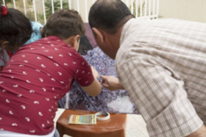
Using maps, participants can examine different aspects of the focus area (access, walkability, etc.) and visualise their ideas (for example: ‘here we should add this’). Mapping exercises can use satellite images and 3D models of the focus area to engage with the participants. With children, using 3D models can make it easier for them to grasp the complexities (i.e. spatial organisation) of a space and to engage with it in a playful way. Although 2D representations may be more appropriate for younger children. Visualising participants’ ideas can happen through different creative means: stickers, pins, sticky notes, photographs, drawing, etc.
See IFAD’s report on ‘Good practices in participatory mapping’ to learn more about this tool.
Participatory mapping can help address the following questions: • What are people’s locations of interest?
- Where are infrastructures located and distributed (e.g. schools, parks, health centres, water points, places of worship, play areas, markets, public transport)?
- What are people’s needs in these locations?
- What are the spatial problems and opportunities?
- What elements characterise the area or site of intervention, for example: pavements, trees, bins, shops, etc.